
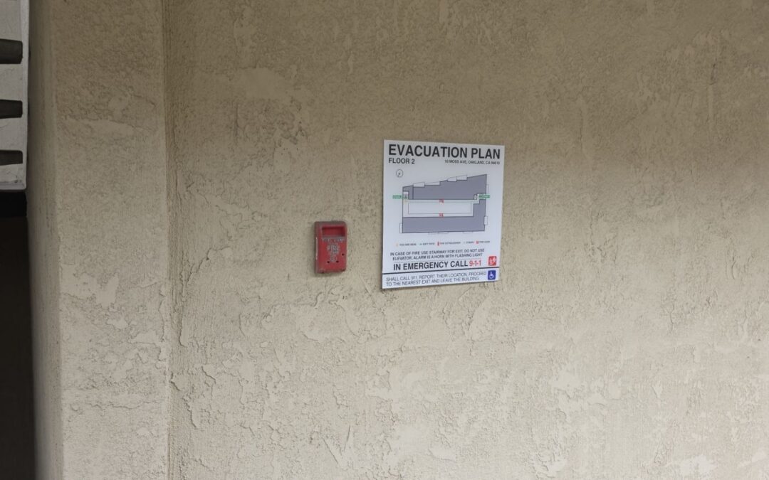
 SignWorks recently completed another evacuation map project in Oakland, CA, this time for a property located at 10 Moss Ave. The project adds another Oakland location to our growing portfolio of custom evacuation maps and fire-safety signage produced for Bay Area properties.
Evacuation maps may look simple when they are hanging on a wall, but creating them requires careful attention to the building layout, installation location, emergency routes, symbols, and local Fire Department requirements. Each map needs to provide useful information that building occupants can quickly understand during an emergency.
For the 10 Moss Ave. project, SignWorks managed the process from map development through completion, with an emphasis on accuracy, readability, and compliance with Oakland Fire Department evacuation map guidelines.
Why Oakland Evacuation Maps Require Careful Planning
An evacuation map is more than a reduced copy of a building floor plan. It is a safety communication tool designed to help people determine where they are and how they can leave the building.
Oakland Fire Department standards call for evacuation maps to be professionally produced, easy to read, accurate, and oriented to the specific location where each map is installed. Required locations can include stairway entrances, elevator lobbies, and public building entrances.
Depending on the building and map location, an Oakland evacuation map may identify important features such as:
- Primary and secondary exit routes
- Stairways and elevators
- Building corridors and door locations
- Fire and life-safety equipment
- Emergency exits
- A prominent “You Are Here” symbol
- Other required emergency information
The goal is to present necessary information without making the map difficult to understand.
The Importance of the “You Are Here” Location
One detail that can make evacuation map projects more involved is map orientation.
The Oakland Fire Department requires each evacuation map to be oriented for its individual installation location. The “You Are Here” marker must accurately show where the person viewing the map is standing. Exit routes then need to make sense from that specific position.
This means a building may require several versions of the same basic floor plan.
A map placed near an elevator may need a different orientation from one installed near a stairway or public entrance. Producing each version correctly helps building occupants quickly connect the drawing with their actual surroundings.
From Building Information to Finished Evacuation Maps
Producing custom evacuation maps involves several steps before fabrication.
The process can include reviewing available floor plans, identifying map locations, checking exit routes, adding required symbols, preparing artwork, making corrections, and completing revisions required during the approval process.
Important details must remain clear even after a large architectural drawing is reduced to the smaller format used for an evacuation map.
For the 10 Moss Ave. project, completing this process allowed SignWorks to move from building information and map development to finished fire-safety signage ready for the property.
Fire Department Requirements Can Vary by City
One reason experience matters with Bay Area evacuation maps is that requirements are not necessarily identical from one jurisdiction to another.
A format used for a San Francisco property, for example, should not automatically be assumed to meet Oakland requirements. Local fire departments may have their own expectations for symbols, layouts, wording, map orientation, placement, or the approval process.
Oakland’s published standard is detailed. Among other requirements, it addresses sign readability, minimum size, floor-plan content, exit-route markings, symbols, and map orientation.
Understanding those local requirements early can help reduce unnecessary revisions and keep a project moving toward completion.
Building on Our Montecito House Evacuation Map Project
The 10 Moss Ave. project follows another recent SignWorks evacuation map project at Montecito House in Oakland.
For Montecito House, SignWorks completed eight evacuation maps after working through the required review and approval process. Once approval was completed, the maps moved into fabrication and were later installed at the property.
Projects like Montecito House and 10 Moss Ave. give SignWorks additional experience working with Oakland Fire Department evacuation map requirements and the details involved in producing location-specific maps.
Each building is different, so previous experience does not replace a careful review of the next property. It does, however, help our team understand the level of detail required when preparing new map artwork.
More Than Evacuation Maps
SignWorks has spent years producing safety and code-related signage for properties throughout the San Francisco Bay Area.
Our work includes:
- Custom evacuation maps
- ADA-compliant signs
- Fire and life-safety signage
- Building directories
- Directional and wayfinding signs
- Parking and regulatory signs
- Property identification signage
These products serve commercial buildings, residential properties, healthcare facilities, property managers, developers, contractors, and public agencies.
While the sign types may be different, successful projects have something in common: information needs to be accurate, easy to understand, and appropriate for the location where the sign will be used.
Another Completed Oakland Evacuation Map Project
The completed 10 Moss Ave. evacuation map project in Oakland, CA, represents another addition to SignWorks’ expanding life-safety signage portfolio.
Oakland emphasizes emergency preparedness and knowing safe evacuation routes before an emergency occurs. Clear building evacuation plans support that larger safety goal by giving occupants location-specific information they can use when leaving a property.
For property managers, developers, building owners, and facility managers, evacuation map projects require more than attractive graphics. They require careful review of floor plans, accurate exit information, correct map orientation, readable artwork, and attention to local requirements.
With nearly two decades of Bay Area sign experience, SignWorks, Inc. continues to provide Oakland evacuation maps, fire-safety signs, ADA signage, and custom building signage for properties throughout Oakland and the greater San Francisco Bay Area.