![]() Emergency preparedness is a top priority for businesses and organizations, especially in large facilities where navigation can be challenging. Clear and accurate evacuation maps are essential to keeping people safe during emergencies like fires or earthquakes.
Emergency preparedness is a top priority for businesses and organizations, especially in large facilities where navigation can be challenging. Clear and accurate evacuation maps are essential to keeping people safe during emergencies like fires or earthquakes.
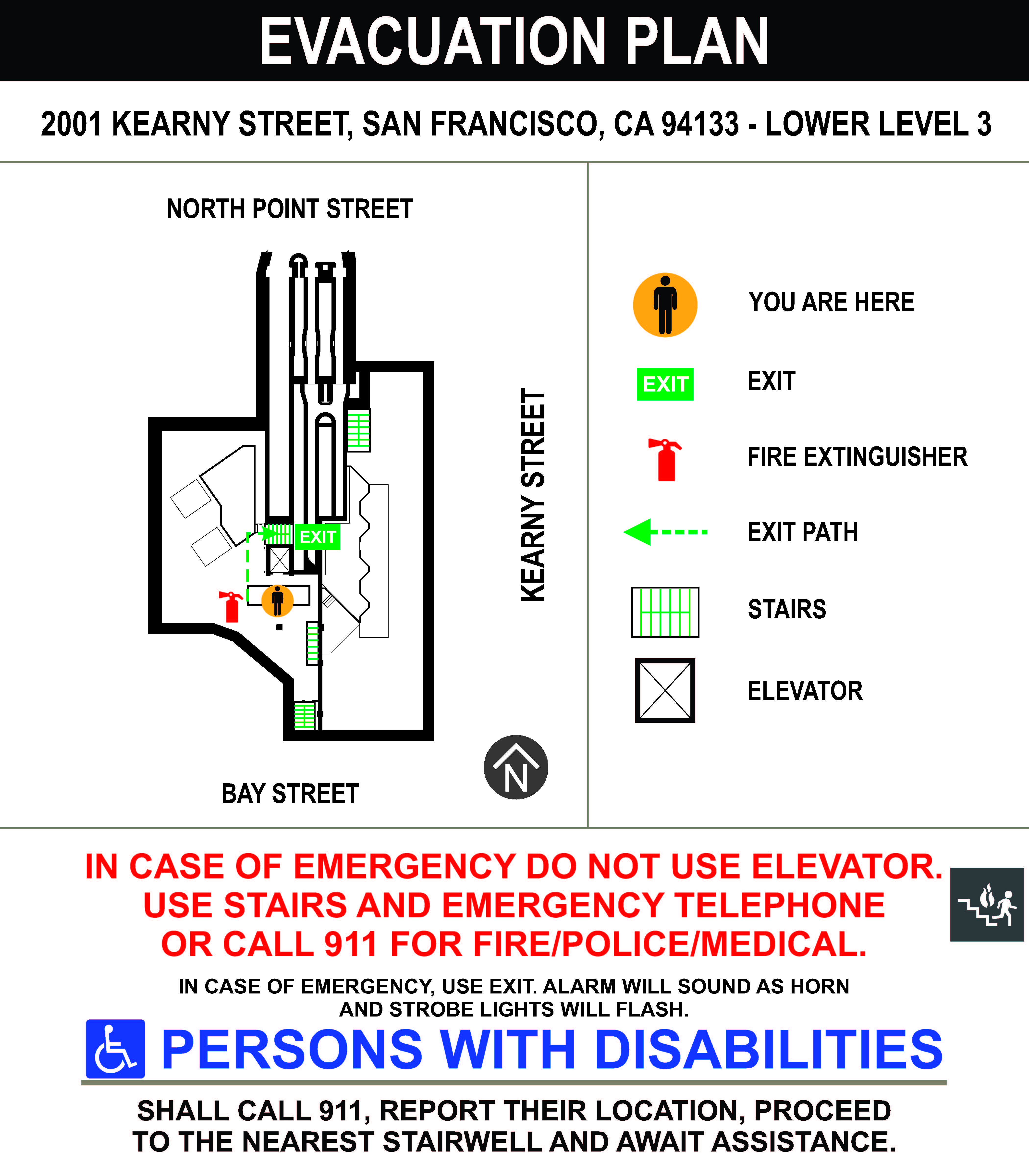
Recently, SignWorks completed an evacuation map project for Western Water, whose client is a major utility company that occupies an entire block on Kearny Street in San Francisco, CA. This project showcased SignWorks’ expertise in detailed planning, precise design, and professional installation to create life-saving signage.
But this isn’t the only evacuation map project we’ve worked on! SignWorks has provided custom evacuation maps for various companies and organizations across the Bay Area. Let’s dive into the details of this latest project and some of our past work.
The Western Water Evacuation Map Project
Western Water needed updated evacuation maps for their client’s large utility building in San Francisco. Given the facility’s size—spanning an entire city block—it was crucial to create detailed and accurate maps that met fire safety regulations and were placed in strategic locations.
Challenges of the Project
- Large Facility: The complex layout made it necessary to carefully map out exits and safety routes.
- Accuracy: The maps had to reflect correct floor plans, emergency exits, and safety equipment locations.
- Compliance: All maps had to meet San Francisco Fire Department regulations.
Project Highlights
✔ Custom-designed maps displaying exits, fire extinguishers, and emergency routes.
✔ Durable materials for longevity and wear resistance.
✔ Strategic placement to ensure visibility for employees and visitors.
✔ Quick turnaround to meet the client’s deadline.
By completing this project, SignWorks helped ensure a safer environment for everyone in the building.
Why Evacuation Maps Are Essential
Emergencies can happen anytime, and when they do, people need to know exactly where to go. Evacuation maps help by:
- Identifying emergency exits for quick and safe evacuations.
- Marking fire extinguishers and safety equipment locations.
- Guiding first responders through the building.
- Ensuring compliance with fire safety regulations.
Without these maps, people may panic or get lost, increasing risk during emergencies.
SignWorks’ Experience with Evacuation Maps in the Bay Area
SignWorks has extensive experience designing and installing evacuation maps for businesses, schools, hotels, and transit facilities throughout the Bay Area.
Other Evacuation Map Projects
Here are some past and current evacuation map projects we’ve worked on:
- Oakland Airport BART Connector
Public transit locations need well-placed and easy-to-read evacuation maps to help passengers and employees quickly find emergency exits. SignWorks worked with the Oakland Airport BART Connector to provide custom evacuation maps that clearly guide people to exits and safety equipment in case of an emergency.
- Boutique Hotel in Palo Alto, CA
Hotels need clear evacuation and floor maps to ensure guest safety. SignWorks designed evacuation maps for a boutique hotel in Palo Alto, ensuring that guests understand the emergency routes. The maps were installed in hallways and guest rooms for maximum visibility.
- Office Buildings in Oakland
For large office spaces, updated evacuation maps are a necessity. SignWorks partnered with several large office buildings in downtown Oakland to design maps that are easy to read and strategically placed at key exit points.
- Schools and Universities
Educational institutions require detailed evacuation plans for students and staff. SignWorks has worked with several Bay Area schools and universities to provide customized evacuation maps that ensure safety and compliance with fire regulations.
What Makes SignWorks’ Evacuation Maps Stand Out?
When it comes to emergency preparedness, attention to detail matters. SignWorks takes pride in delivering high-quality evacuation maps that meet all safety requirements while being easy to read.
- Custom Designs
Every building is different, so each evacuation map must be specifically tailored to the facility’s layout.
- High-Quality Materials
Our maps are printed on durable, long-lasting materials that can withstand time and cleaning.
- Compliance with Fire Codes
We ensure that all our evacuation maps meet local fire department regulations and safety standards.
- Clear and Easy to Read
We use bold colors, simple symbols, and clear labels to make navigation easy.
- Fast and Professional Installation
Once the maps are completed, we install them in the right locations to ensure they are visible and useful.
Conclusion
Evacuation maps are a crucial part of emergency preparedness. SignWorks is proud to have completed another successful evacuation map project with Western Water in San Francisco, ensuring that a major utility company is fully equipped with clear and effective emergency signage.
With years of experience and a strong reputation for high-quality evacuation maps, SignWorks continues to be a trusted expert in safety signage across the Bay Area. Whether your business needs custom evacuation maps for offices, hotels, schools, or transit facilities, we can help design, fabricate, and install the perfect solution.
Need updated evacuation maps for your facility? Contact SignWorks today, and let’s work together to create a safer space for everyone!