
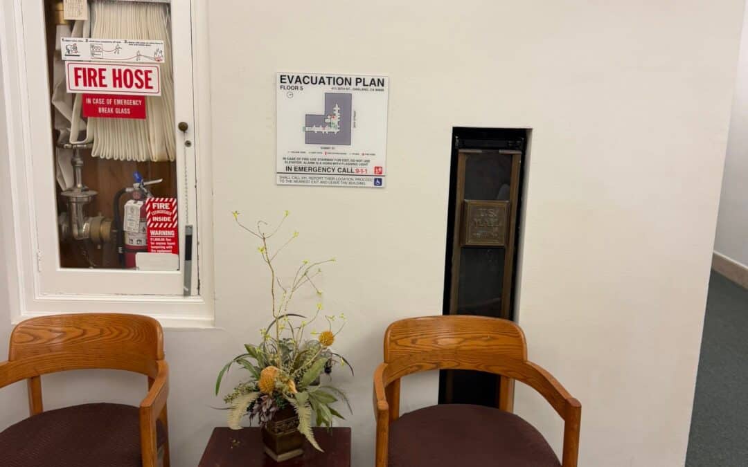
 A quick internet search produces many evacuation map templates and do-it-yourself design services. A diagram can appear complete at first glance yet still leave out information or formatting required by the agency responsible for reviewing that specific building.
Through years of Bay Area life-safety sign work, SignWorks has prepared custom evacuation plans for multifamily housing, homeowners’ associations, commercial facilities, and other buildings requiring locally reviewed maps in Oakland and San Francisco. Every assignment is developed around the individual property, with the artwork progressing from building information and initial layout through agency-requested changes and final sign production.
SignWorks currently has seven evacuation map projects in its pipeline, reflecting continued demand for locally prepared life-safety signage.
Online Evacuation Maps vs. Code-Compliant Maps
Ready-made evacuation diagrams sold online offer a quick way to display basic emergency information. However, they may not address the rules that apply to a particular building or city.
Online products may include:
- Exit routes
- Stair locations
- Fire extinguishers
- Alarm pull stations
- Room identification
- “You Are Here” markers
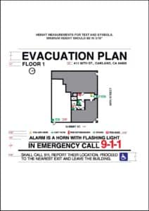 A Fire Department-reviewed map can require much more. Lettering, emergency symbols, route markings, viewing position, sign dimensions, mounting location, and graphic organization may all be subject to specific standards.
Without property-specific information and knowledge of the applicable requirements, an off-the-shelf diagram may need to be redesigned before it can be considered for approval.
San Francisco Evacuation Maps Require Detailed Planning
The San Francisco Fire Department maintains detailed standards for emergency evacuation signage. When an evacuation sign is subject to SFFD approval, its proposed design must be submitted and accepted before SignWorks can proceed with manufacturing the finished piece.
Current SFFD requirements address such details as the “EVACUATION PLAN” header, contrast, symbol dimensions, street identification, exit paths, “You Are Here” markers, floor-plan orientation, and installation locations.
The evacuation diagram must also represent actual building conditions. This is an important difference between a custom SFFD-approved evacuation map and a generic diagram purchased online.
Oakland Evacuation Map Experience
SignWorks has also completed numerous evacuation map projects for Oakland properties.
During an Oakland evacuation map project, agency reviewers may return the artwork with requested adjustments that must be incorporated before the drawings can advance to the next step. A review response might call for a different travel path, revised emergency markings, relocated information, or changes to how the floor plan is visually presented.
Recent SignWorks Evacuation Map Projects
Montecito House — Oakland
SignWorks recently completed eight evacuation maps for Montecito House in Oakland. Throughout the review, SignWorks incorporated the requested corrections into the drawings until the artwork was accepted, after which the eight finished signs were produced and installed.
Montecito House is a good example of how detailed the approval process can become, since reviewer-requested adjustments continued to shape the artwork until an acceptable final version was reached.
30th Street Complex — Oakland
Another project involves a complex on 30th Street in Oakland. The evacuation maps are being developed around the property’s floor plans rather than adapting a standard internet template.
Oakland HOA Project
SignWorks is also working on evacuation maps for an Oakland homeowner’s association. For this assignment, each drawing is being created from the property’s own floor configuration, with the artwork adjusted according to where the finished sign will be mounted.
Creating the artwork around the actual building and sign location gives occupants a diagram that corresponds with the surroundings they encounter at that point in the property.
Bridge Housing — San Francisco
For a Bridge Housing property in San Francisco, SignWorks produced three 16-by-20-inch evacuation maps that received San Francisco Fire Department approval.
Following acceptance of the final drawings, SignWorks produced the three maps using non-glare acrylic lenses and then mounted the completed signs at the San Francisco property.
Additional San Francisco Properties
SignWorks’ San Francisco portfolio also includes evacuation signage prepared for residential developments where separate structures and different floor configurations required individualized map artwork.
Projects of this type show why one evacuation diagram cannot always be duplicated throughout an entire property.
Why Evacuation Map Orientation Matters
A downloadable template may show emergency information without accounting for the direction an occupant will actually be looking when standing in front of the finished sign.
For custom evacuation maps, the floor-plan view can be arranged according to the map’s installation position. Nearby corridors, stairs, and exits can then be understood in relation to what the person sees around them.
San Francisco’s evacuation sign requirements specifically call for floor plans to be oriented to the viewer’s position and require the installation location to be identified in the plans.
Seven Evacuation Map Projects in the Pipeline
Seven additional evacuation map assignments are presently on the SignWorks schedule, with each one at a different point between initial artwork preparation and final manufacturing.
Each property can introduce different conditions, including floor layouts, exit locations, mounting positions, and agency comments. That makes individual project planning especially important.
Bay Area Experience with Life-Safety Signage
Years of producing signs for Bay Area buildings have given SignWorks practical knowledge that is especially useful when tackling detailed evacuation map assignments.
The process can include reviewing architectural plans, creating map artwork, responding to agency comments, making revisions, fabricating the approved signs, and completing installation.
Building owners and property managers in Oakland and San Francisco can use this customized approach when their project calls for evacuation signage created specifically for local review rather than an off-the-shelf internet product.
SignWorks begins with the building’s own floor plans, exit locations, and proposed sign positions, then develops each evacuation diagram around those conditions and the instructions provided by the reviewing agency.
Whether the assignment involves an Oakland apartment community, a San Francisco residential property, an HOA, or a commercial facility, SignWorks applies its hands-on knowledge of evacuation map preparation to create building-specific life-safety graphics and guide the artwork through the steps required before production.