 Staying safe during an emergency starts with knowing where to go and how to get out quickly. That’s why evacuation maps are so important. These special signs help people find exits, stairwells, and emergency equipment when there’s a fire, earthquake, or other emergency.
SignWorks has years of experience creating these safety signs for buildings all across the Bay Area. Right now, we’re working on a big project for a property management company with buildings in San Francisco. They’ve asked us to update evacuation maps at several apartment buildings—and the project is growing!
Let’s take a closer look at how the process works and how SignWorks is helping make these buildings safer for everyone.
What Are Evacuation Maps?
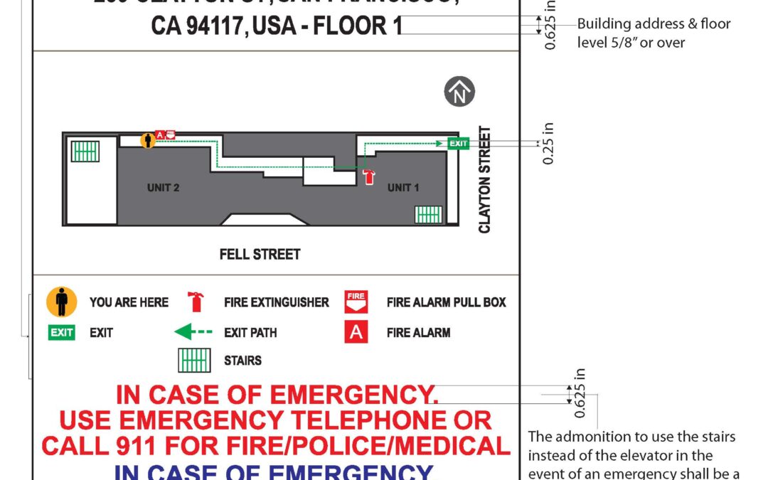
Evacuation maps show people how to get out of a building safely. These maps are placed in hallways, near exits, or by elevators. They include important things like:
- “You Are Here” symbols
- Exit routes and stairways
- Fire safety tools like extinguishers and alarms
- Areas to avoid (like elevators during a fire)
- Emergency contact info
These signs help people stay calm and find their way to safety.
The Project: 9 Properties (and Now 8 More!)
Last fall, a large property management firm contacted us. They needed updated evacuation maps for nine apartment buildings in San Francisco. We started the design process and were going back and forth with the client and the City for approvals. But halfway through, the building owner paused the project, which also paused the city’s approval cycle.
The San Francisco Fire Department (SFFD) asked us to create a legend sheet for each building. These special sheets help make sure that all maps follow the city’s safety rules and design standards.
Good news: The project is back on! The first property located on—Clayton Street in San Francisco—has been fully approved, and we’re now fabricating all nine evacuation maps for that building.
Even better news: The client is adding eight more buildings to the project this week! That means our team will soon begin designing a whole new set of evacuation maps to help even more residents stay safe.
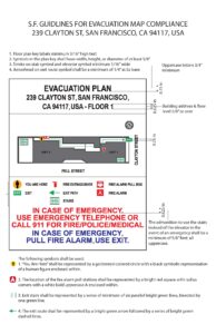
Understanding San Francisco’s Evacuation Map Guidelines
San Francisco has very specific rules for how evacuation maps must be made and installed. These rules help make sure the maps are easy to read and understand quickly. Here are some of the key guidelines:
- Signs must be posted at eye level in main hallways and near exit doors.
- A bold “You Are Here” mark must show where the viewer is standing.
- Clear arrows should show exit paths and stairs.
- The map must clearly point out where important safety equipment—like fire extinguishers, alarms, and emergency tools—can be found.
- Maps must be “oriented,” which means the top of the map should match what you see in front of you.
These rules are reviewed by Fire Department staff, who check every map before it can be approved.
What Materials Do We Use?
Evacuation maps are made to last. That’s why we use strong, long-lasting materials like:
- PVC sheets – sturdy and clean-looking
- Anti-glare Acrylic Lens – easy to read in any lighting
- Full-color prints – bold and bright for fast understanding
- Tamper-resistant mounting – keeps maps in place and undamaged
Using the right materials helps the maps hold up over time and stay easy to read.
Our Experience with Safety Signage
At SignWorks, we’ve been designing and installing evacuation maps for more than 16 years. We’ve worked with many clients in San Francisco and Oakland and know what each city requires for map approval. Our experience includes:
- Working directly with Fire Department plan checkers
- Making legend sheets that follow every city guideline
- Updating old maps so they meet today’s standards
- Installing maps exactly where they need to go
Because we’ve done this so many times, we can guide our clients through the process step by step—and help speed up approvals.
Next Steps: More Designs and More Approvals
Now that the Clayton Street property maps are approved and headed to fabrication, we’re waiting for the San Francisco Fire Department to review the maps for the other eight original properties. We expect to begin fabrication on those as soon as they get the green light from the city.
Meanwhile, we’re gearing up to start designs for the eight new properties just added to the project. That means creating new floor layouts, applying the city’s design rules, and making sure every detail is correct. Our team is ready to get started and keep this important safety work moving.
Why Clients Trust SignWorks
This project shows why property managers and building owners choose SignWorks again and again. Here’s what makes us stand out:
- ✅ We understand San Francisco’s Fire Department rules
- ✅ We design maps that get approved the first time
- ✅ We meet tight deadlines and help clients stay on track
- ✅ We use quality materials and expert installers
Even when a project pauses or changes, we stay flexible and focused on getting it done right.
Final Thoughts
Evacuation maps keep people safe. They are one of the most important safety signs in any building. They help save lives by showing people where to go in an emergency. At SignWorks, we’re proud to play a part in making San Francisco buildings safer—one map at a time.
With Clayton Street underway, eight more buildings awaiting approval, and eight brand-new properties starting soon, we’re ready to keep the momentum going. If your building needs updated evacuation maps or any kind of life-safety signage, contact SignWorks today. We’re here to help guide you through the process and create signs that keep people safe.